
Ptarmigan Traverse 1999
Diary
24 July 1999 Garry Stephenson leaves
his pickup at the Downey Creek Trailhead, while I check out the weather
forecasts and Ptarmigan Traverse trip reports at the Marblemount RS. It
is drizzly at the RS, reportedly wet at Cascade Pass. We decide to wait
out the weather until tomorrow. The five of us, Garry, me, Keith Garlinghouse,
Pam Otley, and Bill Saur rent a mobile home at Clark's Cabins off the
highway. Since we pay with Garry's credit card we name this "Camp Stephenson".
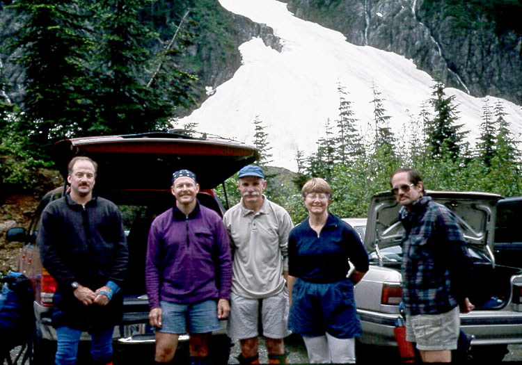
The Ptarmigan Traverse Team
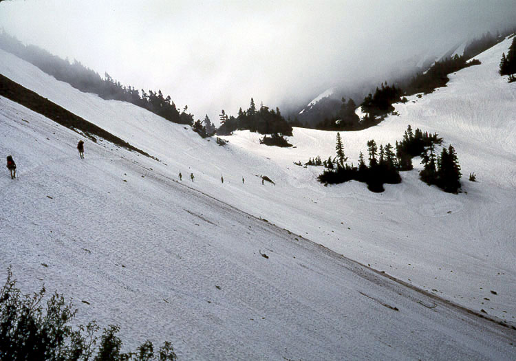
Approaching Cascade Pass
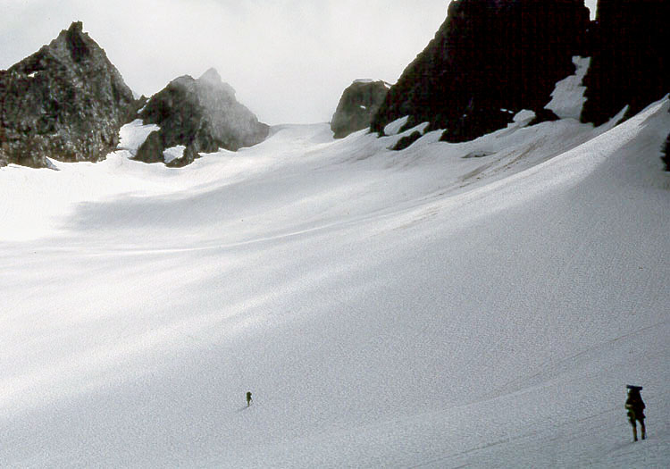
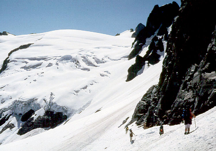
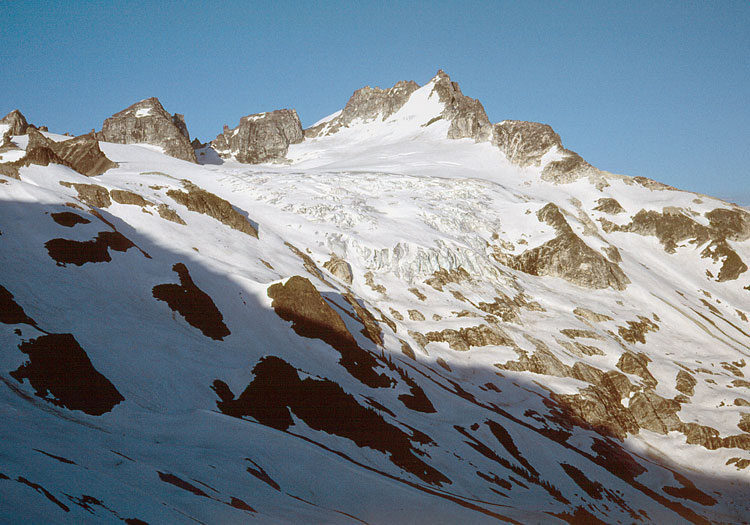
Approaching Cache Col
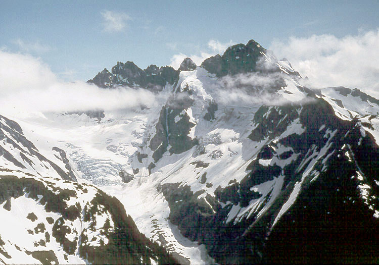
Mt Formidable from Cache Col
25 July Hike to Kool Aid Lake (6100')
via Cache Col (6900'). Meet a party of four (from the Portland area) at
Cache Col who had spent a wet night camped above Cascade Pass. Camp on
snow beside the snow-covered lake. Climb to just below the summit of Magic
Mountain in the afternoon, but turn back due to steep snow since we left
our ropes and crampons at camp. We note the Red Ledges just beyond camp,
the crux of the traverse according to a ski party two weeks earlier.
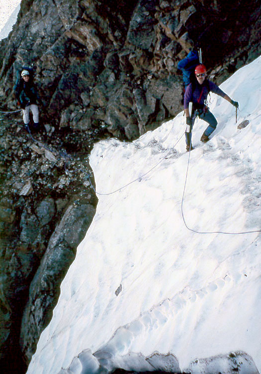
Crossing the Red Ledges
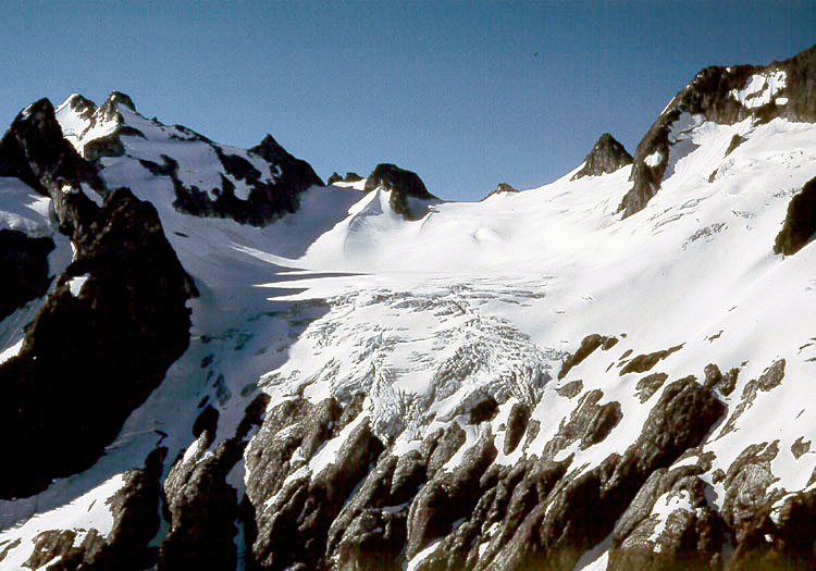
LeConte Mtn from Spider-Formidable Col
26 July Climb through the Red Ledges
to find the Portland party breaking camp. Traverse steep snow to the Middle
Cascade Glacier and climb it to the Spider/Formidable Col (7320'). Note
a steep traverse below Le Conte Mountain to reach the Le Conte Glacier
tomorrow. Descend to Yang Yang Lakes (5830'), crossing wet, steep snow
to reach the lakes. Camp on heather at the partially frozen lake, noting
also the steep snow gully above camp. The Portland party pass by in the
evening and ascend the snow gully above, apparently unroped.
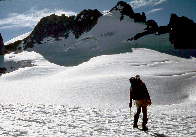
Traversing onto the LeConte Glacier
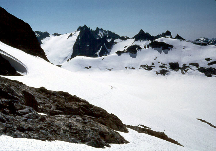
Traversing above South Cascade Glacier
27 July We start the day by climbing
up through the gully, then traverse below Le Conte Mountain to the Le
Conte Glacier. Meet the Portland party and another party before climbing
the glacier to Sentinel Saddle (7280'). Le Conte Glacier is just starting
to open up but is not a problem to cross. We traverse above the South
Cascade Glacier until below a snowfield leading upward to Sentinel Peak.
Bill and Keith climb Sentinel Peak, but Garry and I turn back below the
rock to avoid crossing above a deep moat without a rope. We rejoin Pam
and wait for Bill and Keith to return. Continue on to Lizard Pass (6800')
and drop down steep snow to White Rock Lake (6200') to camp. This steep
descent would likely have been a problem in the morning, so we are glad
to have pushed on to the lake rather than camping in the sunshine above.
Also, it gives us ample time to puzzle out how we are going to try to
reach the Dana Glacier tomorrow morning. The easiest approach seems quite
steep from camp, and we are concerned about tomorrow's route.
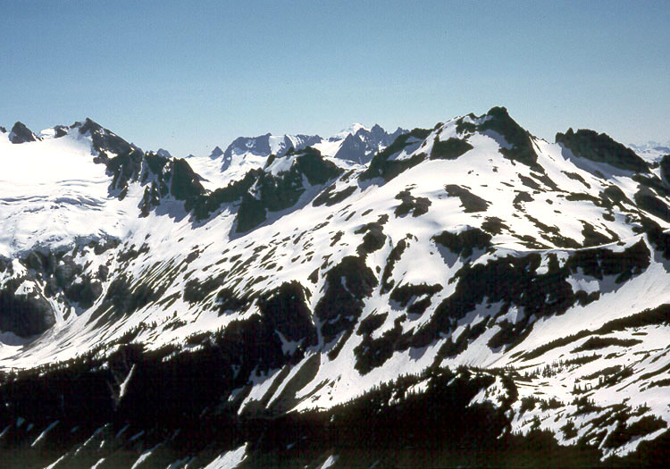
Dana Glacier from White Rock Lake
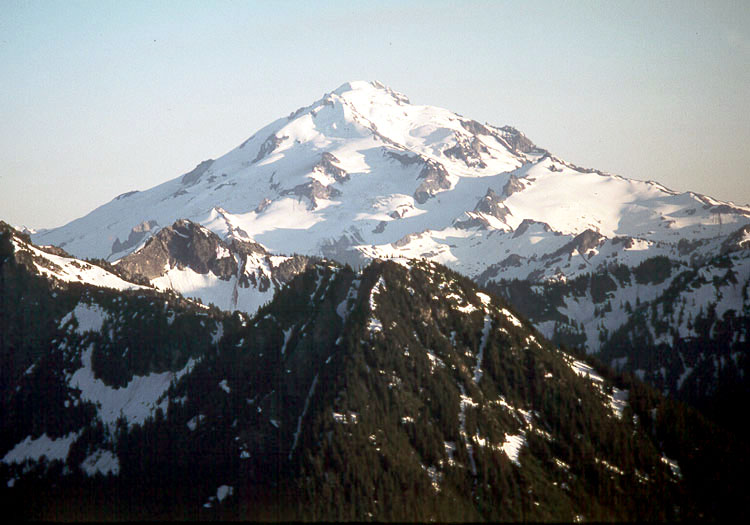
Glacier Peak from Itswoot Ridge
28 July Leave White Rock Lake ahead
of the Portland party. Drop down looking for a trail but find steep icy
snow slopes instead. Bill and I start traversing one steep slope without crampons,
but advise the others to use crampons before very carefully continuing across
the icy snow above a cliff band.
Traverse down further to access the Dana Glacier and discover
the slope is much less steep than it appeared from White Rock Lake. Ascend
the Dana Glacier to Spire Col (7760') which we identify using a GPS and
map. Here is our first view of Glacier Peak and it is very impressive
and scenic. Drop down the other side of the Col and find a camp on Itswoot
Ridge (about 6300'). We have finished the high traverse and feel very
satisfied.
Dome Peak from Itswoot Ridge
Dome Peak from Dome Glacier
29 July Climb Dome Peak from our Itswoot
Ridge camp. Return to camp where the Portland party has arrived. Break
camp and descend steep snow to Cub Lake, then climb over the pass to drop
down into the Bachelor Creek drainage. Try to find a campsite at timberline,
but don't find anything pleasant. Find the trail leading further down
the drainage and follow it to a campsite along Bachelor Creek lower. Light
rain that evening.
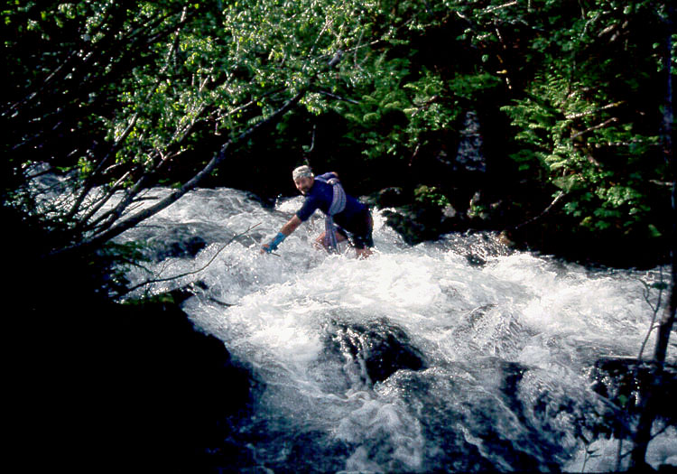
Keith fording Bachelor Creek
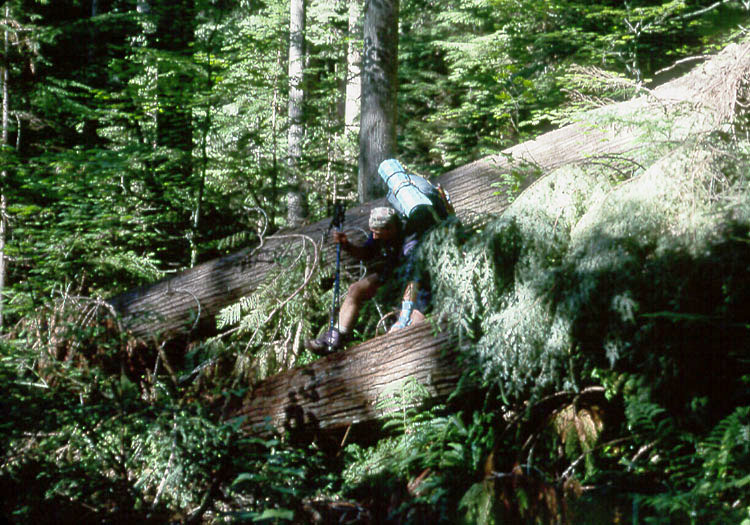
Descending the Downey Creek Trail
30 July Continue down the Bachelor Creek Trail. Fight brush, then discover we need to ford the creek. Water is high and flowing fast. Decide to keep our boots on and wade across one at a time. Empty out our boots on the other side, then follow the trail downward to Downey Creek. Here I mistakenly think we need to cross Downey Creek to find the trail out to Garry's truck. We try to ford Downey Creek with arms locked, but the water is too high and Pam is getting lifted off her feet. We find a large log across the creek and shuffle across one at a time. We check the map and discover we should not have crossed Downey Creek, so we retrace the crossing and find the trail just downstream of where the Bachelor Creek Trail ended. The Portland party catches up with us and leads out. We were warned of a lot of downed timber along Downey Creek, so I begin to count each tree we need to step over or squat/crawl under. I count 68 trees. Pam counts more. We finally arrive at Garry's pickup and enjoy a celebratory beer. What an adventure!
References
Mt. Baker-Snoqualmie National ForestNorth Cascades National Park
