
Bicycle Idaho, 2001
Background
We had enjoyed participating in several Oregon Bicycle Ride tours, and when we heard that the same company, Bicycle Rides Northwest, was organizing a similar tour in Idaho we knew we wanted to try it.
Itinerary
| Day | Start | Stop | Mileage | Elevation Gain |
|---|---|---|---|---|
| July 15 | Melba | Mountain Home | 74 | 1890 |
| July 16 | Mountain Home | Fairfield | 60 | 3730 |
| July 17 | Fairfield | Ketchum | 54 | 1930 |
| July 18 | Ketchum | Stanley | 64 | 4080 |
| July 19 | Stanley | Lowman | 58 | 2650 |
| July 20 | Lowman | Montour | 58 | 2000 |
| July 21 | Montour | Melba | 57 | 1980 |
|
Totals
|
425 | 18260 | ||
Diary
14 July 2001 (Saturday)
Linda and I leave home for Melba, Idaho. At Vale, Oregon, Linda discovers that she forgot to pack her bike shoes. We check a phone book at Nampa, and decide to try a bike shop in Boise. Here she finds a nice pair of bike shoes and I find a "Full Sail Ale" jersey I've been looking for. We both leave satistified.
We arrive in Melba and find the camp at the school's football field. We register for the ride, set up our tent, and have dinner. In the early evening we have a big wind storm blowing dust.
15 July (Sunday)
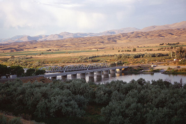
Snake River Crossing
We leave Melba and drop down through pasture land to cross the Snake River on Highway 45. From here we turn southeast on Highway 78 and head towards Murphy.
There are dark thunderclouds to the south, and we spot lightening ahead of us. We pass through Murphy with a stop at the Murphy General Store and continue towards Grandview. Soon we are in a thundershower. It is the first thundershower I have experienced in an early morning. The shower ends as we cycle on, and it is warming up as we arrive at Grandview and our last snack stop of the day.
We turn north on Highway 67 towards Mountain Home. We pass a huge stockyard with many cattle waiting for their destiny. It is a memorable and disturbing sight. Beyond the stockyard we climb up onto a plateau and escape the flies.
It is getting hot as we turn onto a divided highway and ride into Moutain Home. We find our camp at a school and spend the rest of the afternoon hydrating ourselves. On bicyclist faints and is taken to a hospital where he is diagnosed with dehydration.
16 July (Monday)
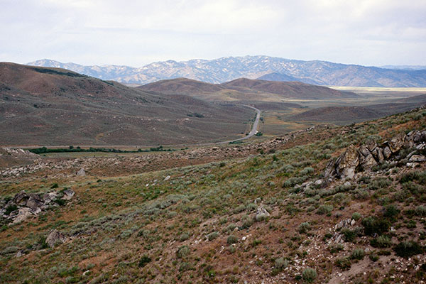
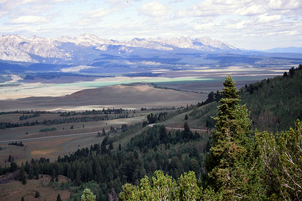
View from Cat Creek Summit
From Mountain Home we bicycle under I-84 and onto Highway 20 to the east. We have a long climb over a series of summits, eventually arriving at scenic Cat Creek Summit and our second snack stop.
The route levels off and we pass through Hill City and Corral before arriving at the Fairfield City Park for our camp. Camp is close to downtown and we explore Fairfield in the afternoon.
17 July (Tuesday)
After a community-provided breakfast we leave Fairfield and continue riding east on Highway 20. It is cooler and threatening rain, which we eventually ride through on the rolling terrain. We have a snack stop at a park near the intersection with Highway 75, then follow Highway 75 north towards Ketchum. The traffic is heavy, but at nine miles we are able to turn onto an excellent bike path which takes us into Ketchum.
Our camp is at the Ketchum City Park. It is raining, and we have been told we cannot use tent pegs (this is later retracted). Linda and I are eager to dry out and the rain does not appear to be tapering off so we find a motel several blocks from camp. We enjoy our private shower and balcony, then explore downtown Ketchum before returning to camp for dinner.
Several bicyclists spent the afternoon watching Lance Armstrong decisively win a mountain stage on the Tour de France. Linda and I discover the stage is being broadcast over our motel TV cable on OLN and we get to watch the last climb of the stage.
18 July (Wednesday)
Cool Morning Ride
On the way to Galena Summit
Linda and I decide to have breakfast downtown before carrying our bags to camp for loading onto the truck. Breakfast at camp has been delayed, so we get an early start on most of the riders. The temperature is cool, but the skies are clear as we climb toward Galena Pass.
Sawtooth Range from Galena Overlook
The summit elevation is 8701 feet, the highest of the tour, and the ride up has been scenic. We begin the drop on the northern side and soon stop at the Galena Overlook. The view of the Sawtooths and the valley below us is very scenic and memorable. This is definitely an area to revisit later.
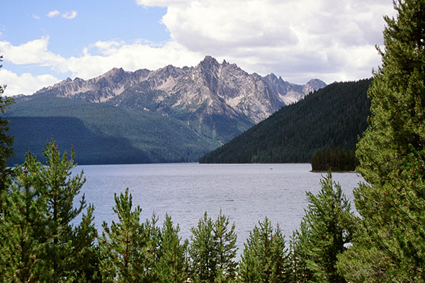
Redfish Lake
The descent to the valley is fast, then levels off. We enjoy a gradual descent and strong tailwind the rest of the way to Stanley -- what a combination of scenery and pleasant riding. Camp is at the Stanley City Park on a hill above Stanley with excellent views of the Sawtooths.
19 July (Thursday)
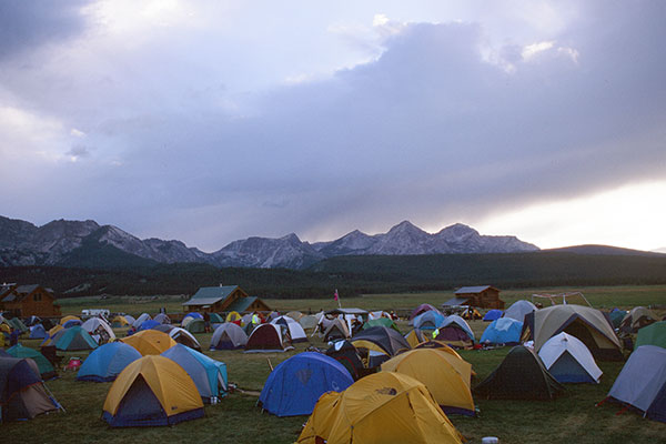
Cool morning camp at Stanley City Park
It is cold in Stanley as we descend the gravel road to our breakfast at a community center.
We get an early start west on Highway 21 and it immediately pays off, as we are waved through a stretch of road construction after a short wait. We hear later that later the road crew made many bicyclists wait longer and ride through as a bigger group so as not to slow the other traffic as much.
We enjoy and photograph several views of the Sawtooths and enjoy the very nice Ponderosa Pine Scenic Byway with little traffic. We climb over Banner Summit, then enjoy a long descent along the South Fork of the Payette River.
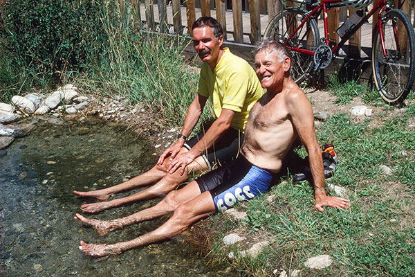
Jim and Roger at Lowman Hot Springs
A few miles short of Lowman Linda and I cross the river at a campground and soak in some hot springs. I climb down to the river and rinse off where the hot water mixes with the cold river water.
We continue on to our camp at the Lowman School. It is a very crowded camp and the tents are packed tightly on a small green section of grass. We are later than most, but find a reasonable site off to the side on dry ground. The shower truck is out of water for most of the afternoon, so many people hike down to the river or are shuttled to hot springs to rinse off before dinner.
20 July (Friday)
We leave Lowman on Highway 582, following the South Fork of the Payette River downstream. I glimpse several patches of steam rising from the river banks as I bicycle, but miss my chances to catch them on film.
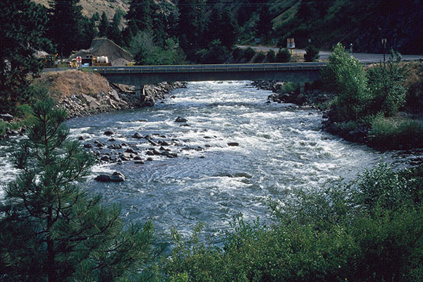
Payette River
We pass through Garden Valley and on to Banks, where we turn south on a very busy Highway 55. The traffic is heavy and the shoulder is variable. We take a break at Coopers Bear Town to view the variety of bear-theme goods and enjoy a latte. We continue on to our last snack stop, then turn onto Highway 52 at Horseshoe Bend to continue following the Payette River and escape the traffic.
After a few more miles we pass the Montour Store and turn left and find camp at a large, lumpy field with little shade adjoining the Montour Campground. Several of us decide to pay a few dollars and set up our tents at pleasant campsites in the adjoining campground in view of the group site.
21 July (Saturday)
We leave camp and retrace our route to Melba for breakfast at a restaurant before continuing west along the Payette River on Highway 52. We pass the Black Canyon Park and enter Emmett, then turn south on Highway 16. We climb onto a rolling plateau and follow the busy highway until we turn off onto a series of back roads as we approach Nampa.
We enjoy the last snack stop of the tour on Highway 44 and say goodbye to the friendly support crew, then continue to the town of Star. Several of us miss the chalk marks and mistakenly continue east on the highway for a few miles before we are tracked down by a SAG vehicle and directed back to Star. The turn is now well marked by a roadside sign, and we get back on route.
Linda lingered a few minutes at the snack stop after me, and correctly made the turn so she is now ahead of me. I try to catch up to her on the remaining 24 miles to Melba, but fail. She is riding strong and I lost too much time near Star. Still, the ride to Melba is a pleasant route, passing through several intersections, along scenic farms, and over I-84.
We enjoy a shower and are treated to a nice lunch at the Melba school before leaving for home. We have met many fun people on the ride, and it was an interesting, scenic, and fun trip. We have already decided to join Bicycle Idaho next year.
