
Nordic Skiing in Central Oregon
Selected Ski Areas
- Mount Bachelor, OR
- Anthony Lakes Mountain Resort, OR
- Arizona Snowbowl, AZ
- Sunrise Park Resort, AZ
- Ski Valley, AZ
- Ski Apache, NM
Selected National Forests
Selected Deschutes Nordic Ski Routes
![]() = Snow Parks
= Snow Parks
Virginia Meissner
The Virginia Meissner Sno-Park is located at an elevation of 5350 feet along the Cascade Lakes Highway (Highway 46, milepost 14). This Sno-Park is very popular and much of the trail system in this area is often groomed for skate and classic Nordic skiers. I have enjoyed Wednesdays Trail in this area as it leads away from most of the traffic until it reaches the road north of the Meissner Shelter. Dogs are not permitted in this area.
Swampy Lakes
The Swampy Lakes Sno-Park is located at an elevation of 5800 feet along the Cascade Lakes Highway (Highway 46, milepost 16). This Sno-Park has more parking than the Virginia Meissner Sno-Park and its higher elevation offers better snow conditions. Except for the Tangent Loop that leads towards the Virginia Meissner area, trails here are not machine groomed. This area offers several enjoyable loops on trails that are not machine groomed.
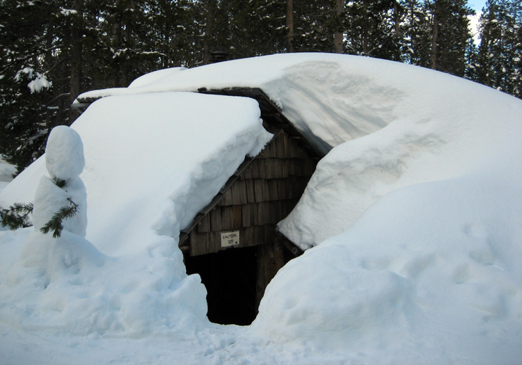
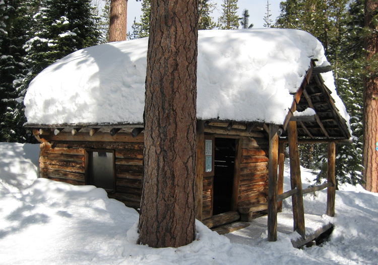
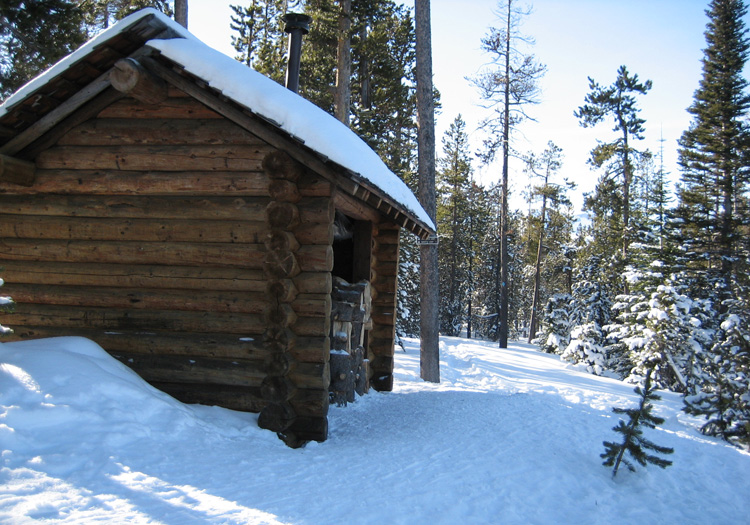
Swampy Lakes Shelter
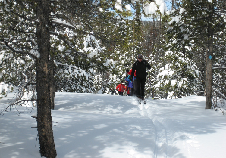
Skiing Flagline Tie Trail
| Trail(s) | Shelter | Distance | Direction |
|---|---|---|---|
| Swampy Lakes Loop | Swampy Lakes Shelter | 4 | clockwise |
| Nordeen Loop | Nordeen Shelter | 5.25 | clockwise |
| Swede Ridge Loop | Swede Ridge Shelter | 7 | counter clockwise |
| Swampy - Flagline - Flagline Tie - Butte - Ridge - Beginner | passes near Swampy Lakes Shelter | 7.75 | counter clockwise |
| Swampy - Ridge - Butte - Vista Butte - Butte - Ridge - Beginner | No shelters on the route. Summits Vista Butte. | 7 ? | counter clockwise on the Ridge Trail |
When it is stormy higher or the highway traffic is heavy this one of my favorites. Dogs are not permitted in this area.
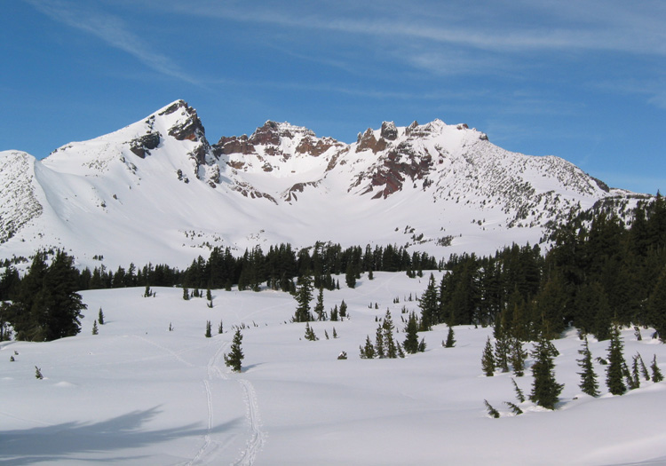
Vista Butte
The Vista Butte Sno-Park is located at an elevation of 5900 feet along the Cascade Lakes Highway (Highway 46, milepost 18), just east of where US Forest Road 45 from Sunriver intersects the Highway. Parking is quite limited. The Butte and Vista Butte Trails lead to the summit of Vista Butte. This is about a 800-foot climb and is a good snowshoe route.
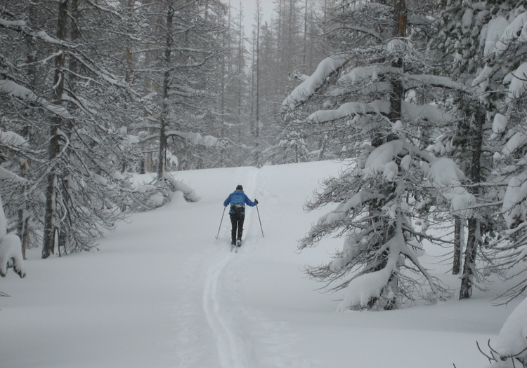
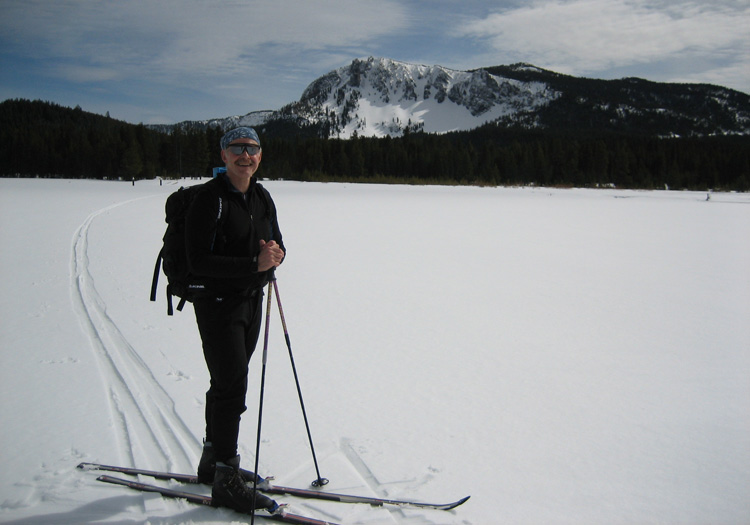
Linda Skiing the Vista Butte Trail
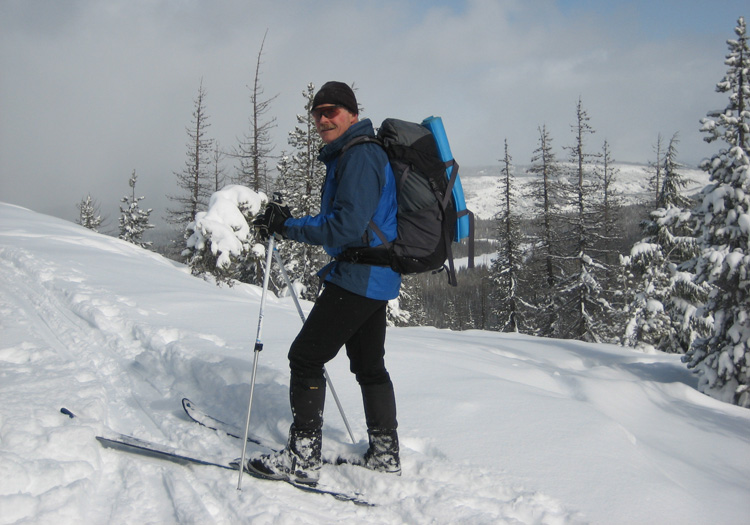
Paul on Vista Butte Summit
Due to the easier parking at the Swampy Lakes Sno-Park and the very enjoyable Butte and Ridge trails in that area I now ski Vista Butte from that Sno-Park. Dogs are not permitted in this area.
Dutchman Flat
The Dutchman Flat Sno-Park is located at an elevation of 6250 feet along the Cascade Lakes Highway (Highway 46, milepost 22), just short of the end of winter highway plowing and the turn to Mt Bachelor's West Village. This is a very popular snowmobile parking area with limited parking. There is access to several Nordic trails leading towards Todd Lake, Big Meadow, and the Three Sisters Wilderness near Broken Top. However, for those destinations I prefer parking at the Mount Bachelor West Village and taking the Nordic Center's Common Corridor to connect with those trails.
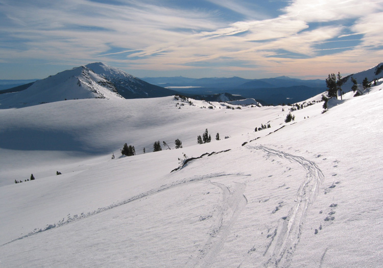
When I park at the Dutchman Flat Sno-Park it is typically to ski or snowshoe directly up Tumalo Mountain, a 1400-foot climb, or as part of a car shuttle where I ski the Flagline Access and Flagline Trails to the Swampy Lakes Area to another car parked at that Sno-Park.
Broken Top in Winter
Skiing on Tam McArthur Rim
| Trail(s) | Shelter | Distance | Direction |
|---|---|---|---|
| Flagline Access - Flagline - Swampy Lakes Loop | Swampy Lakes Shelter | 9.25 | Dutchman to Swampy |
| Flagline Access - Flagline - Flagline Tie - Butte - Ridge - Beginner | Passes near Swampy Lakes Shelter. | 10.75 | Dutchman to Swampy |
| Water Tower - Pete's Way - Big Meadow - Todd Ridge - Todd Lake | No shelters on the route. | from Nordic Center |
Dogs are not permitted in this area November 15 - April 30.
Edison Butte
The Edison Butte Sno-Park is located at an elevation of 5000 feet along US Forest Road 45, 4 miles south of the intersection with the Cascade Lakes Highway (milepost 19 on Road 45). This is a large Sno-Park but is very popular with snowmobilers, skiers, and snowshoers and their dogs and the parking can fill up by early afternoon on a holiday weekend.
This area offers several scenic trails amongst the Ponderosa Pine and seems to be sheltered from high winds when it is stormy in the Mt Bachelor area. The AC/DC Shelter has a view of Mt Bachelor and is accessible using either the "most difficult" Direct Current (DC) Trail or the "more difficult" Alternating Current (AC) Trail. I prefer to climb to the shelter on the DC Trail and enjoy a very pleasant descent on the AC Trail. This loop can be extended by returning on the High Voltage and High Voltage Tie Trails to Edison Shelter and then finishing on the Light Bulb Loop and Tie Trails to the Sno-Park.
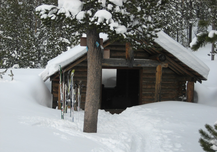
Edison Shelter
AC/DC Shelter
| Trail(s) | Shelter | Distance | Direction |
|---|---|---|---|
| DC Tie - DC - AC - DC - DC Tie | AC/DC Shelter | 5.5 | counter clockwise |
| DC Tie - DC - AC - HV - HV Tie - LB - LB Tie | AC/DC and Edison Shelters | 7.5 | counter clockwise |
There are several trails descending south towards FS Road 4525 but my preference is to stay higher.
Skyliner
The Skyliner Sno-Park is located at an elevation of 4700 feet on Skyliner Road (milepost 9) soon before the road crosses Tumalo Creek and forks to become Tumalo Falls Road. This is a small Sno-Park, but people also park just on the other side of Tumalo Creek near the Tumalo Falls Road gate (road not plowed in winter). This is a very popular area for skiers and snowshoers and their dogs. The trail is accessible from the Sno-Park. Those parking at the gate typically travel on the snow-covered road.
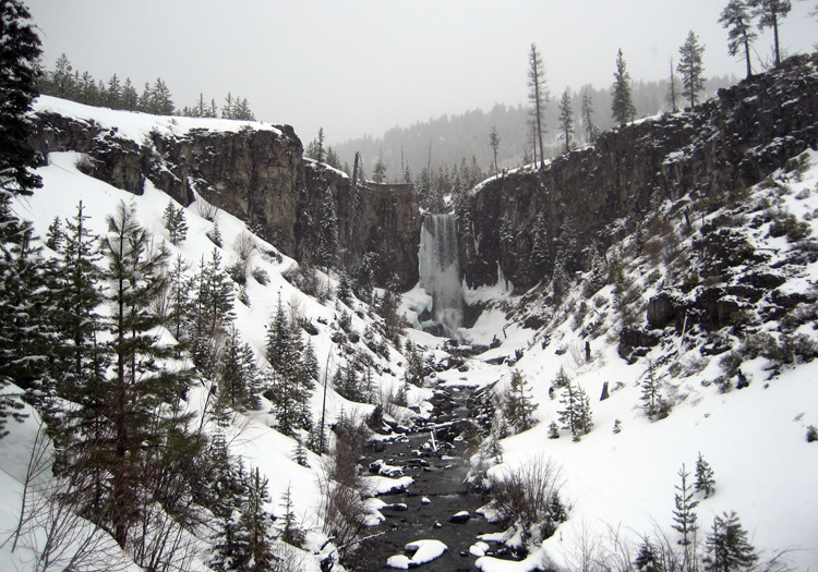
Tumalo Falls in Winter
| Trail(s) | Shelter | Distance | Direction |
|---|---|---|---|
| West Loop - Tumalo Creek - Tumalo Creek Nordic Loop | none | clockwise |
It would be interesting to see if the South Fork Trail from Swampy Lakes Shelter is easy to follow on snow.
Three Creeks
The Upper Three Creek Sno-Park is located at an elevation of 5100 feet beside the Three Creek Road (FS Road 16) about 11 miles south of Sisters. You pass the Lower Three Creek Sno-Park at 9.5 miles and that may be an alternative parking location if the road is not adequately plowed higher.
Jefferson View Shelter
| Trail(s) | Shelter | Distance | Notes |
|---|---|---|---|
| Three Creek Lake - Snow Creek | passes near Jeff View Shelter | 11 | 1300' net elevation gain |
| Three Creek Lake Trail to Three Creek Lake | passes near Jeff View Shelter | 12.5 | out and back |
The Three Creek Lake Trail starts at the Sno-Park and follows a forest road south 4 miles to its intersection with FS Road 16, passing by Jeff View Shelter at about 2.5 miles. Follow FS Road 16 about another half mile south to the Snow Creek Nordic Trail. Follow this well-marked trail 6.5 miles back towards the Sno-Park finishing on Warren's Loop and the Three Creek Lake Trail.
To reach Three Creek Lake, take the Three Creek Lake Trail to FS Road 16 and then follow that road to its end at Three Creek Lake below Tam McArthur Rim.
McKenzie Pass
The McKenzie Sno-Park is located at an elevation of 3800 feet on Highway 242, 7 miles west of Sisters at MP 85. This is a primitive and free parking area beside a forest road on the north side of the highway. The McKenzie Pass eastside gate is about 1 mile further west and officially closes the highway during the winter season. From the Sno-Park it is 4.5 miles to Windy Point (4900 feet) and views of Mount Washingtion and snow-covered lava fields. From the Sno-Park it is 7 miles to McKenzie Pass (5325 feet) and the Dee Wright Observatory, with broad views of the High Cascades to the north and south.
| Trail(s) | Shelter | Distance | Notes |
|---|---|---|---|
| Sno-Park - Windy Point & return | none | 9 | 1100' net elevation gain |
| Sno-Park - McKenzie Pass (Dee Wright Observatory) & return | Dee Wright Observatory (no stove, open windows) | 14 | 1500' net elevation gain |
Newberry Crater
Newberry National Volcanic Monument
NF
Winter Recreation Map
The Ten Mile Sno-Park is located at an elevation of 5560 feet off the north side of the Road 21 leading to Newberry Crater (10 miles east of Highway 97). Road 21 is not plowed beyond this Sno-Park and it is a popular snowmobile route into the Monument.
Two ski trails parallel Road 21. The Paulina View Trail climbs gently through timber to the south of the road. Take a sharp right just above the gate to find this trail. The Ponderosa Rim Trail follows along Paulina Creek to the north of the road.
Skiing on Paulina Lake
| Trail(s) | Shelter | Distance | Notes |
|---|---|---|---|
| Paulina View-Ponderosa Rim | Paulina Lake Resort is nearby | 6.5 |
This loop can be greatly augmented by continuing 4 miles on the Paulina Peak Road (FS Road 2100 500) to the summit of Paulina Peak (7984 feet). Alternatively, follow Paulina Peak Road for about a mile and take a steep trail that climbs the NW ridge to the summit.
Pine Mountain
Pine Mountain Observatory (includes webcam)
The Pine Mountain Observatory is located about 30 miles southeast of Bend at an elevation of 6240 feet on Pine Mountain, about 1.5 miles SW of the summit. The road to the Observatory offers the most convenient access to Pine Mountain for skiing and snowshoeing. To reach this road, take US Highway 20 east from Bend (towards Burns). About 26 miles from Bend you will see the Millican store on your right and just east of it the Pine Mountain road is on your right. This road is cinder and climbs to the Observatory in about 8 miles.
At about 3.3 miles the road crosses a third cattle guard and a subsidiary road branches to the left. A sign "Pine Mountain Observatory 5 Miles" indicates one should continue straight on road 2017. In about 0.2 mile further the road enters the Deschutes National Forest and begins climbing a narrow canyon.
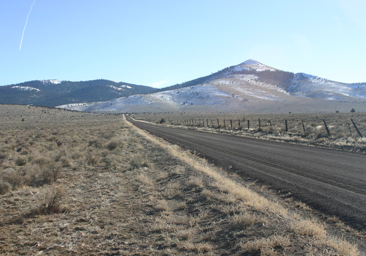
Pine Mountain from near Millican
The Pine Moutain Road is lightly maintained in the winter and may have deep snow or ice with deep ruts. Be prepared by carrying chains and a snow shovel and use a vehicle with good clearance. At 0.9 mile after entering the Deschutes National Forest there is typically a small pullout on the left where a forest road drops down at about 5250 feet. Depending on the road conditions this may be a prudent place to park and you might wish to ski the the road leading up to the left from this spot..
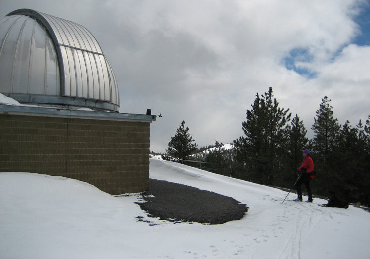
Linda Skiing at Pine Mountain Observatory
From this parking spot the Pine Mountain Observatory is about 1000 vertical feet and 3.5 miles further up the road, offering a scenic ski through Ponderosa Pine forest. Two forest roads lead off to the left at about 5460 and 5600 feet and can offer interesting ski traverses to the east with good views of the Millican Valley. The summit of Pine Mountain (6509 feet) may be accessed most directly from the upper of these two forest roads. Another forest road leads off to the right at about 6000 feet and leads towards the West Basin Canyon.
