
Bicycle Idaho, 2003
Background
We enjoyed last year's Bicycle Idaho 2002 tour and planned then to join the tour again this year. Last year's route was a loop in Eastern Washington and Northwest Idaho. This year's route is a loop in Southern Idaho with one day's ride overlapping the Bicycle Idaho 2001 tour, but in reverse direction. As always, the tour was organized by Bicycle Rides Northwest, a company based in Bend, Oregon.
Itinerary
| Day | Start | Stop | Mileage | Elevation Gain |
|---|---|---|---|---|
| July 13 | Jerome, ID | Carey | 60 | 1270 |
| July 14 | Carey | Arco | 43+ | 1300+ |
| July 15 | Arco | Challis | 85 | 4280 |
| July 16 | Challis | Stanley | 64 | 1300 |
| July 17 | Layover in Stanley | |||
| July 18 | Stanley | Hailey | 75 | 2560 |
| July 19 | Hailey | Jerome | 64 | 980 |
|
Totals
|
391+ | 11690+ | ||
Diary
12 July 2002 (Saturday)
We drive to Jerome, Idaho, from our home in Bend. We take US 20 across Oregon and at a snack stop in Burns we hear we have missed a morning accident near Juntura to the east that closed the road for a couple of hours. When we pass through the same area later we see that a more recent accident has just occurred. For some reason, this is a dangerous highway today.
The rest of the drive is uneventful and Linda makes good time driving
on I-84 in Southern Idaho. We register at the Jerome High School and meet
friends from previous rides. We find some shade for our tent between the
sidewalks and are joined by Doug and Jackie. Late tonight we are awoken
by someone repeatedly driving at high speed near our camp.
13 July (Sunday)
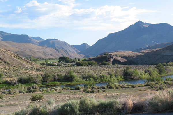
Bicycling on the Snake River Plateau
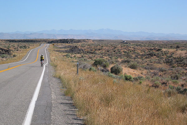
We leave Jerome to the north along back roads, then follow Highway 93 to Shoshone across the Snake River Plateau. We turn northeast to Richfield and enjoy a strong tailwind. The easy route continues to Carey where we stay at the Blaine County Fairgrounds.
It is hot and we guess how the
sun will set to select how best to use the yet unclaimed shade. Not having
taken a compass I rely on the layout of the streets and misjudge, leaving
the tent in the hot sun until sunset. We take a short walk in town. More
noisy driving up and down the street near camp during the night.
14 July (Monday)
Ranch and foothills
We ride east out of Carey on Highway 20 in the cool morning through desert and lava flows. The lava flows increase in size until we reach the Craters of the Moon National Monument where lava and cinder cones dominate the scenery.
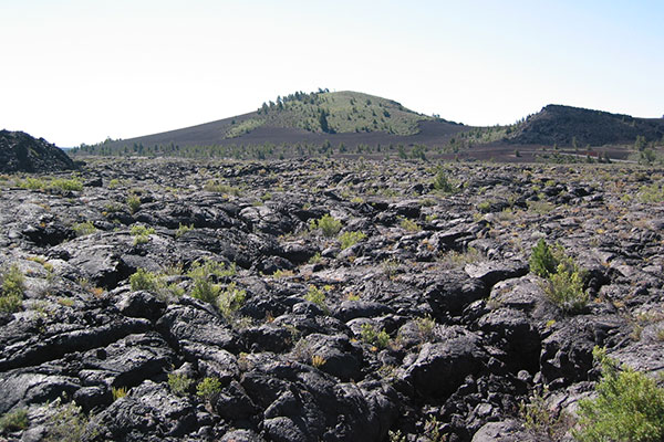
Craters of the Moon National Monument
After a stop at the Visitors' Center we decide to enter the monument and ride the paved loop, stopping at the Devil's Orchard, Inferno Cone, and the Splatter Cones, before enjoying a roller-coaster ride down a 10% drop on the backside of the loop.
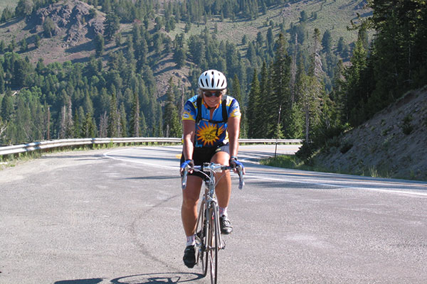
We return to Highway 20 and descend towards Arco, visible in the distance. Don passes us as we ride and I get inspired to try to catch him. After miles of hard riding I finally catch him as we enter Arco.
I'm able to find a nice shaded spot at the
City Park for our tent. We visit downtown Arco for a milkshake and visit
with the friendly local people. Linda attends the talent show at the adjoining
school after dinner. In the middle of the night many of us are awaken
by someone shouting obscenities at the camp. I hope for better sleeping
when we enter the mountains tomorrow.
15 July (Tuesday)
Today is a long, hot ride that begins with a strong headwind that lasts from Arco to Mackay. Linda and I find a pleasant cafe just off the main street in Mackay and enjoy our first lattes of the ride.
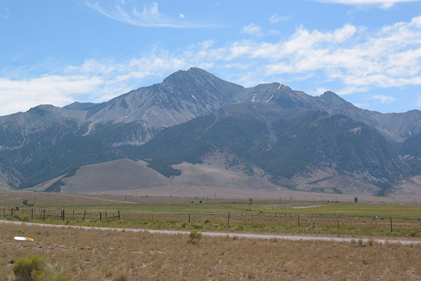
Borah Peak, Highest in Idaho
We leave Mackay and begin climbing. The wind is calmer, but it is getting hot. I try to guess which peak is Borah Peak and photograph every candidate. Eventually, I find an information board and other clues that allow me to pick out the correct peak.
The highway continues north and climbs to a summit and a water stop with lots of welcome fruit and drink. It is quite hot now. We descend through Grandview Canyon and it gets hotter as we approach Challis. We eventually cross the Salmon River, but then need to climb one more hill before entering Challis and finding camp at the City Park.
16 July (Wednesday)
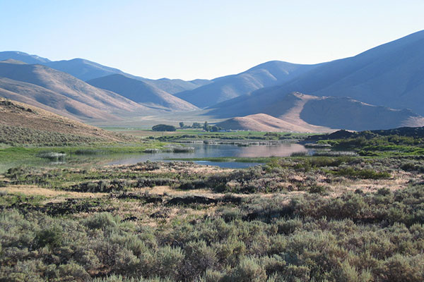
Ranch along the Salmon River
Today's ride is a scenic one along the Salmon River, but begins with a strong headwind that lasts for several miles as we ride through canyons west of Challis. Eventually the headwind diminishes and the riding gets easier.
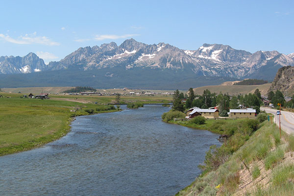
Salmon River, Stanley, and the Sawtooths
A mining operation, several ranches, and the river offer many
interesting views. Eventually the rocky Sawtooths come into view as we
approach Lower Stanley. The peaks rise above our camp at Stanley Park.
17 July (Thursday)
Today is a layover in Stanley. An optional out and back bike ride is available, but we sleep in, then join a whitewater trip on the Salmon River to the east of Stanley.
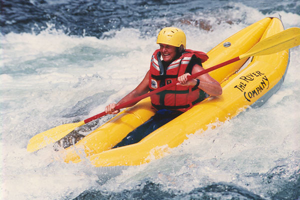
Linda kayaking on the Salmon River (Sawtooth Photography)
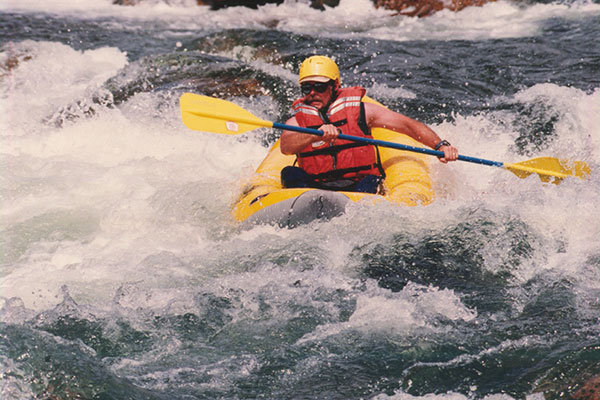
Paul kayaking on the Salmon River (Sawtooth Photography)
Linda and I and a few others signed up last night for the inflatable kayaks. We don our wet suits and enjoy the whitewater on the kayaks while others ride the paddle boats. The inflatable kayaks seem quite stable and maneuverable through the rapids. Linda relinquishes her kayak for a while to another who wants to try it but eventually gets it back for the finish.
18 July (Friday)
Linda climbing to Galena Overlook
We get a cold and early start to begin our gradual climb up the valley on Highway 75 towards Ketchum. After 27 miles we begin the steeper ascent to Galena Pass.
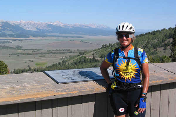
Linda at Galena Overlook
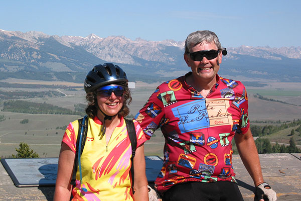
Jackie and Doug at Galena Overlook
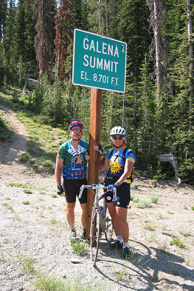
The ascent is constant but scenic and we enjoy an excellent view of the Sawtooths from Galena Overlook before topping out at Galena Summit. This is the highest elevation point of our tour.
It's downhill from here!
The descent towards
Ketchum on the other side is fun. There is a headwind as we drop lower
but we feel strong and set a fast pace to Ketchum. We take a break and
enjoy a big smoothie in downtown Ketchum. From Ketchum we follow an excellent
bike trail to Hailey where we camp at a shadeless small park in the hot
afternoon.
19 July (Saturday)
We leave Hailey and enjoy a fantastic tailwind southward. There are some rolling hills south of our crossing of US 20 on our way to Shoshone and we ride in a pace line for a few miles. I ride fast the last few miles to Jerome for a strong finish.
Linda and I plan to take the same route
home, but a few miles west of Vale we find a line of vehicles waiting
at another serious accident. Rather than wait indefinitely we decide to
return home by way of Highway 26 and John Day. It is a pretty route, part
of which we will bicycle over on our self-supported bicycle trip
later in the summer.
